





According to the news agency Online news Quoting Faradid; Today, on the eastern coast of the Halkidiki peninsula in Greece, there are the remains of an ancient canal that was dug by order of Xerxes. The canal bisected the Athos peninsula and connected the Irisos Gulf in the north to the Sinigitic Gulf in the south.
The purpose of building this waterway was to prevent the repetition of the disaster that the Iranian fleet had faced in the previous campaign to Greece. This channel was abandoned after the end of the war and was gradually filled with sediments. The account of Herodotus, the Greek historian, faced doubt for more than two thousand years; Until new scientific investigations showed that this structure really existed.
A sea disaster that worried the Achaemenid court
In 492 BC, during the reign of Darius the Great, the Iranian army under the command of Mardouniyeh began its first major campaign to Greece. But the Iranian fleet was caught in a fierce storm while passing near the Athos peninsula.
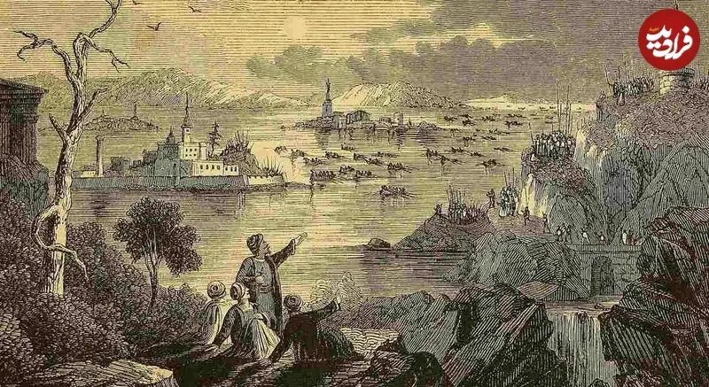
Herodotus writes that about 300 ships and 20 thousand Iranians died in this incident. The ships were smashed against the rocks and many soldiers drowned or died from the extreme cold. This disaster practically destroyed the hope of success of that campaign.
About a decade later, Xerxes prepared for a more extensive invasion of Greece. This time, the Iranians were determined to avoid repeating that failure. For this reason, in 483 BC, an order was issued to dig a channel through the Athos peninsula so that the Iranian fleet would not have to pass through the dangerous waters around it.
How did Iranian engineers dig a canal through the land?
Digging a waterway to connect the two bays was a huge project and required a lot of manpower and engineering knowledge. Two Iranian engineers named Bobars and Artakhe took responsibility for the implementation of the project. Thousands of workers participated in this project; including forces from Phoenicia and Egypt and local residents who were employed.
In order to prevent the walls from collapsing, the engineers designed the channel in such a way that the width of its upper part is twice the width of the floor. According to Herodotus, Xerxes had ordered that the waterway be wide enough for two three-rowed ships to cross at the same time, side by side, with their oars open.
After three years, the project was finished. The length of the canal was about 12 stadia, equivalent to approximately 1900 meters. Embankments were built at both ends so that the sea waves do not cause sediments to enter and fill the road.
channel; Part of the imperial supply chain
Xerxes’ campaign to Greece was one of the largest military operations in the ancient world. Provision of supplies and equipment for such an army was as important as the battles themselves.
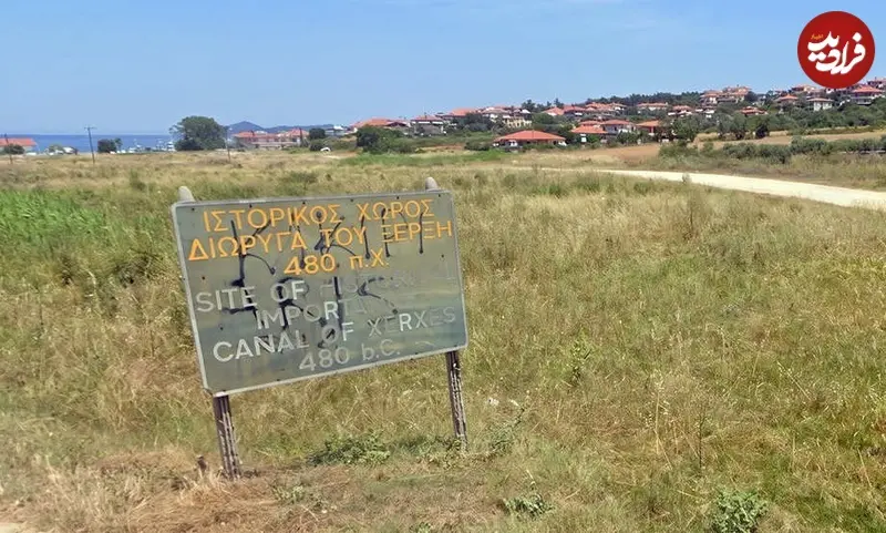
The Athos Canal was not just built to allow ships to cross the peninsula, but was part of Iran’s extensive supply network. This network, along with the bridge built over the Hellespont strait, allowed for the transfer of troops and supplies. Warehouses were also created along the way to store provisions; Because an army with such dimensions could not rely only on the food resources of the route areas.
This project showed that the Achaemenid government had the ability to mobilize manpower and implement complex engineering projects to overcome natural obstacles. Athos Canal, before the beginning of the main battles, was a tangible manifestation of the strength and determination of the Iranians.
Why did many historians consider the existence of the channel to be a myth?
The most important written source about this channel is Herodotus’ book of history. However, his accounts of huge sea creatures and amazing events made some readers skeptical of his entire narrative.
After the campaign in 480 BC, the canal was gradually filled with sand and sediments, and its effects were less visible. In the ancient Roman period, there was a difference of opinion about the authenticity of this structure. Juvenal, the Roman satirist poet, considered the story of ships passing through Mount Athos as an example of false stories in Greek history.
These doubts continued until the new era. However, some researchers and geographers, including William Martin Lake, a British officer and geographer, pointed to field evidence that could confirm the existence of the canal.
How did science prove the existence of the channel?
Geographical surveys began at the end of the 18th century and continued in the 19th century. By studying the features of the land and the possible route of the waterway, the researchers found evidence that was consistent with Herodotus’ report.
In the 1990s, geophysical investigations, including seismic studies and sediment analysis, provided stronger evidence. The results showed that a channel-like path extended across the width of the peninsula. In this way, the existence of a structure that some considered a myth for more than two thousand years was confirmed by scientific evidence.
Today, the remains of this waterway are reminders of a project that was designed to solve a real military problem; A plan that shows how Achaemenid engineering served logistics, fleet movement and natural hazard management.
259